The Reconfiguration of (Public) Space through AI
Citizens, Society and Artificial Intelligence (CiSAI)
Central questions
- How do spaces, their meaning, and use change when they become continuously monitored and controlled?
- How do citizens perceive and react to such management of space?
- What opportunities does AI hold for a more efficient and fair use of public space, including for example transportation infrastructure?
- How do we use remote sensing to understand urban dynamics? And how do planners use big data to shape spatial interventions and what is its role in planning and decision-making processes?
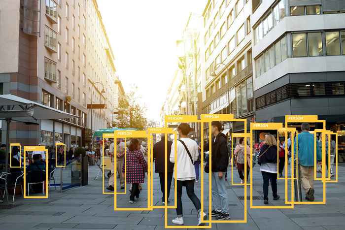
- How can AI and public camera surveillance help social scientists to understand and explain crime, conflict, and violence better?
- How can social scientists integrate AI and video analysis?
- How can social scientists draw on AI and public camera surveillance without contributing to oppressive state policies?
Ongoing research
The use of AI in the future of mobility
Researchers: Anna Nikolaeva, Marco te Brömmelstroet.
Machine Learning for understanding urban dynamics
Researcher: Mendel Giezen
The use of AI to detect behavior in public space from public camera recordings during the Corona pandemic
Researchers: Cees Snoek, Marie Rosenkrantz Lindegaard, Benjamin van Rooij, Andreas Schuck
The use of AI to detect conflict behavior from public camera recordings
Researchers: Cees Snoek, Marie Rosenkrantz Lindegaard, Don Weenink
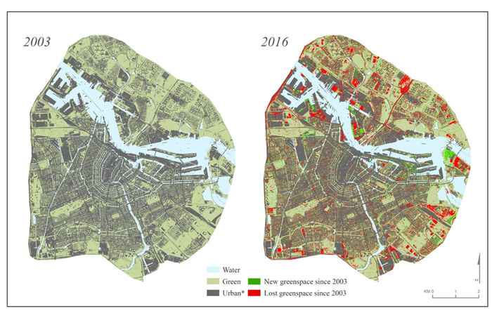
Aided by satellite images and remote-sensing technology, Mendel Giezen and colleagues revealed a decrease in the amount of green space in Amsterdam.
More information?
Visit the overview page of our platform Citizens, Society and Artificial Intelligence (CiSAI).